Charlotte
One of the areas early settlements, Charlotte, was incorporated into the city on
The area where the river meets the lake was originally a triangular marsh. To alleviate the build up of sand bars which interfered with navigation, piers extending into the lake were first built in 1829. The effort was successful and sand began to build up behind the piers forming beaches. This sand along with other added material eventually filled the marsh. The piers now extend about 0.5 mile into the lake.
Ontario Beach Park
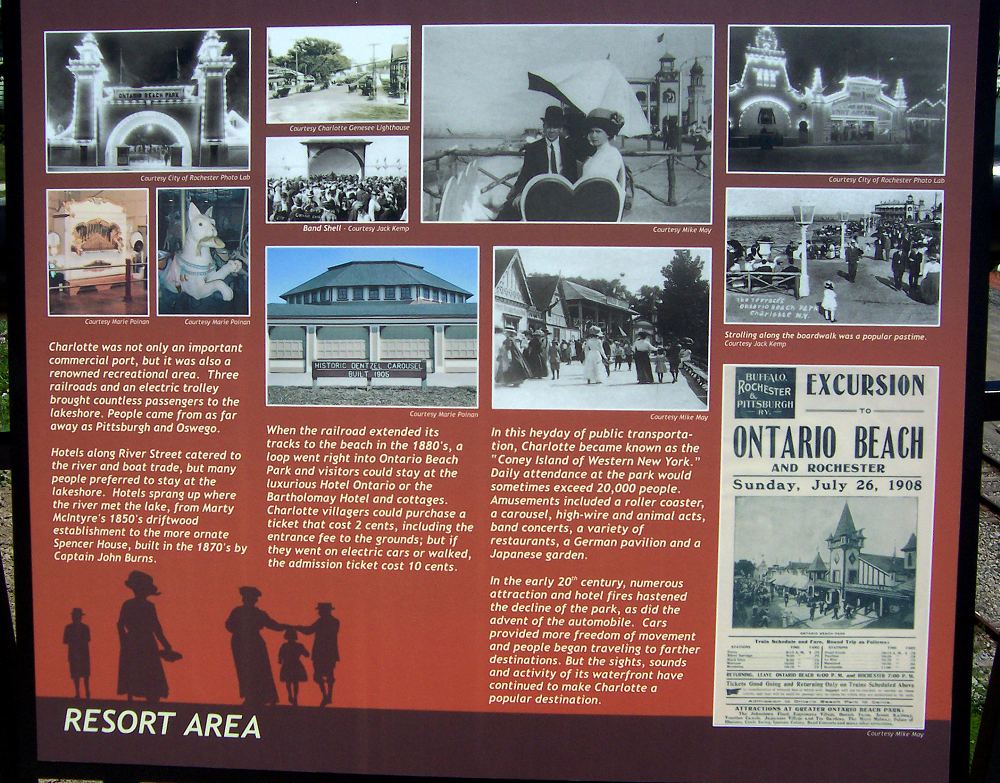
The area 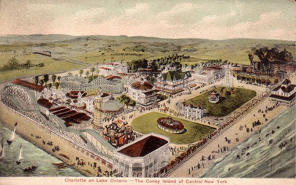 around Rochester's Lower Falls was the area's major lake shipping and entertainment area until about 1880. The completion of a railroad to Charlotte in 1853, the building of Rochester's first electric street car line to the beach in the early 1890's and generally improved transportation moved these functions to Charlotte toward the end of the 19th century. Beginning in the 1850's many Rochesterians spent their summers in tents erected on the Lake Ontario shore. Eventually more permanent buildings were constructed followed by several hotels. Sponsored by the NY Central Railroad and a local brewery, an amusement park opened here in 1884. The park flourished becoming known as the "Coney Island of the West". There was a scenic railroad (roller coaster), Virginia Reel, circle swing, Venetian canal boat ride, carousel and a foolish house. Other attractions included a penny arcade, tintype gallery, camera obscura, shooting gallery and a band stand. Vaudeville acts, wild animal shows, fireworks displays, concerts and daredevil performances attracted thousands.
Eventually the park began to lose popularity. Many of the aging buildings burned, Prohibition brought the loss of support from breweries and the development of the automobile allowed the development of areas not served by public transportation. By the 1920's many of the buildings had been removed. The carousel is the only period attraction that remains.
Port of Rochester
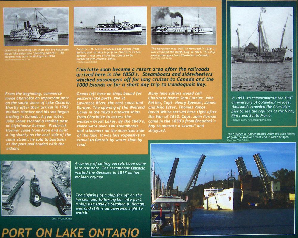
Charlotte has been the port of the Genesee since 1805. 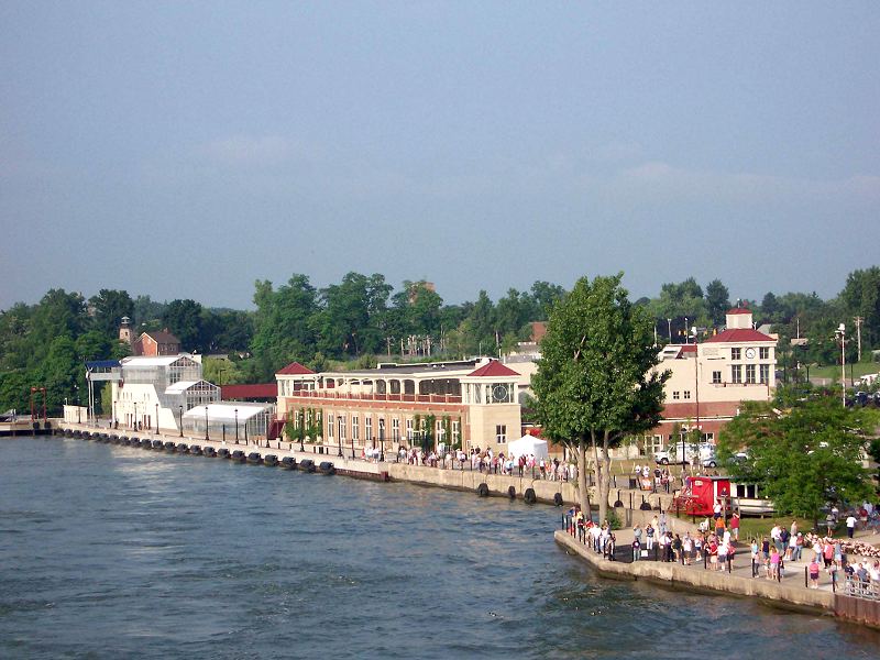 The port of the Genesee covered a large area east and west of the river and the Collector was stationed at Charlotte. The collector was at Charlotte but water transportation was much easier than land transportation so the actual boat landings were located several miles upstream in the vicinity of the present Veteran's Memorial Bridge.
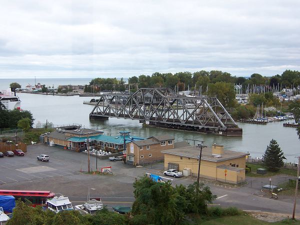
 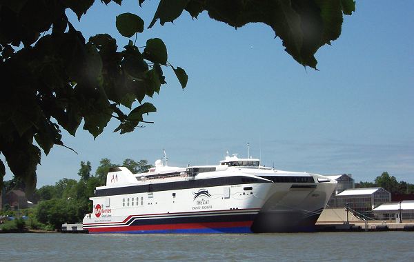 The current terminal building was built in 1922 on the site of an old blast furnace. The slag from the furnace supplied fill for the marsh. By the 1970's the terminal was a warehouse storing mostly newsprint and tomato paste. Ragu was a local Rochester company. In 2003-4 the building was renovated to accommodate the fast ferry "Spirit of Ontario". The ferry ran between Rochester and Toronto for two abbreviated seasons in 2004 and 2005. After large financial losses it was sold to the German company FRS in 2007, renamed Tangier Jet II, and runs in the Strait of Gibraltar between Tarifa, Spain and Tangier, Morocco.
Construction of a Lewiston-to-Oswego railroad, popularly 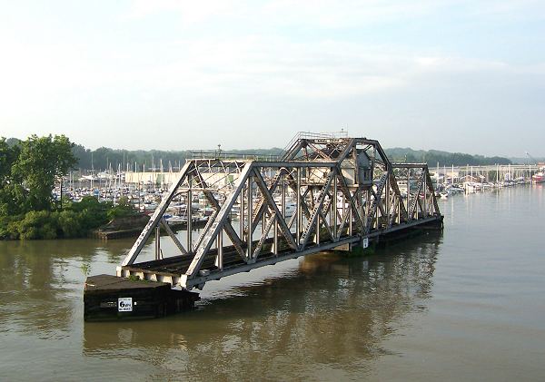 known as the Hojack Line, was begun in 1872, completed in 1876, and combined with the NY Central in 1893. In 1908 a new swivel bridge was erected in the river for trains to cross. This bridge, one of the few remaining swivel bridges, stands in the river at the south end of the terminal. It is currently scheduled for removal.
Proceeding south is the New York Central station. The original burned in 1902 and the present structure was built. To your right on the hill before the railroad station is the lighthouse. The lighthouse is now a long way from the lake shore but when it was built it was near the end of the marsh.
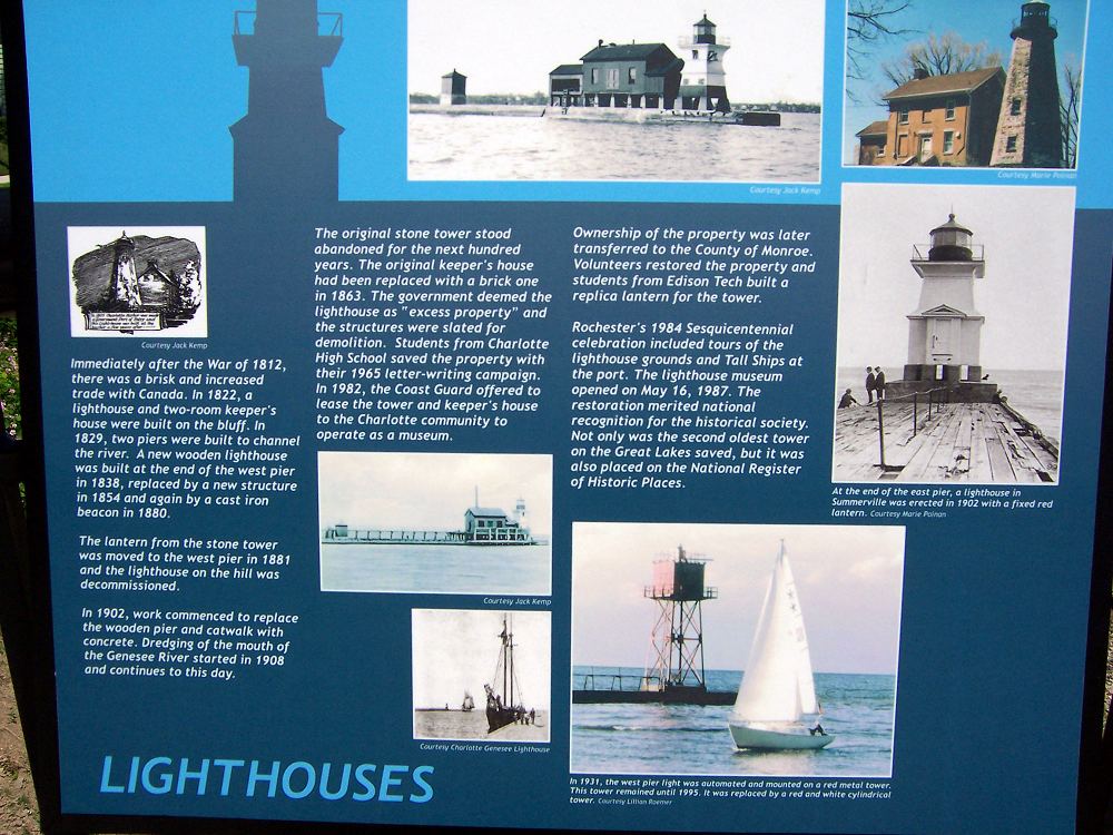
Charlotte Genesee Light House
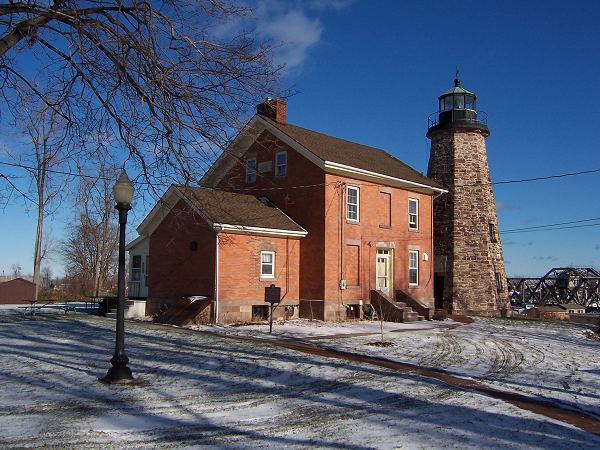
In 1822 a 40 foot light tower and a two room keeper's house were built of stone. It is the second oldest lighthouse in the Great Lakes. In the 1850's the lighthouse was updated and the present keeper's house built to replace the two room structure. In the 1880's the light was deactivated and the lantern moved to the end of the west pier on the Genesee River. In 1983 the property was turned over to the Charlotte-Genesee Lighthouse Historical Society who maintain the property and conduct a museum with displays on the lighthouse, the port, Ontario Beach Park and the village of Charlotte.
Information is available at:
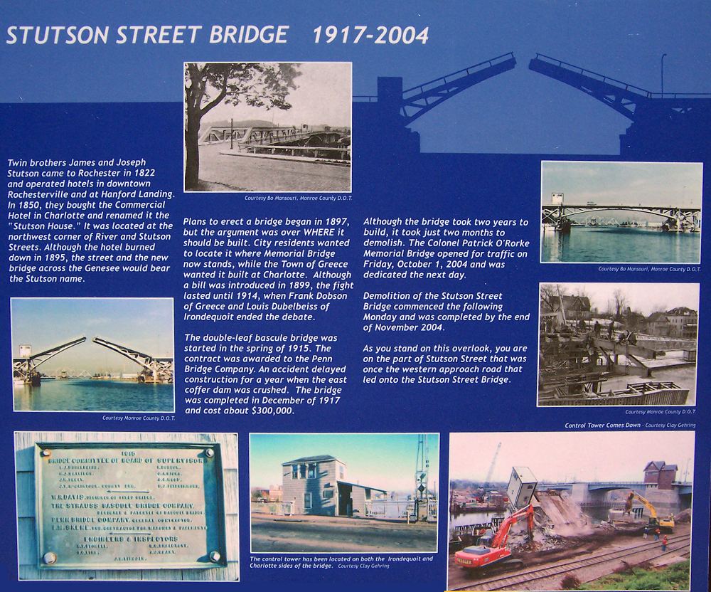
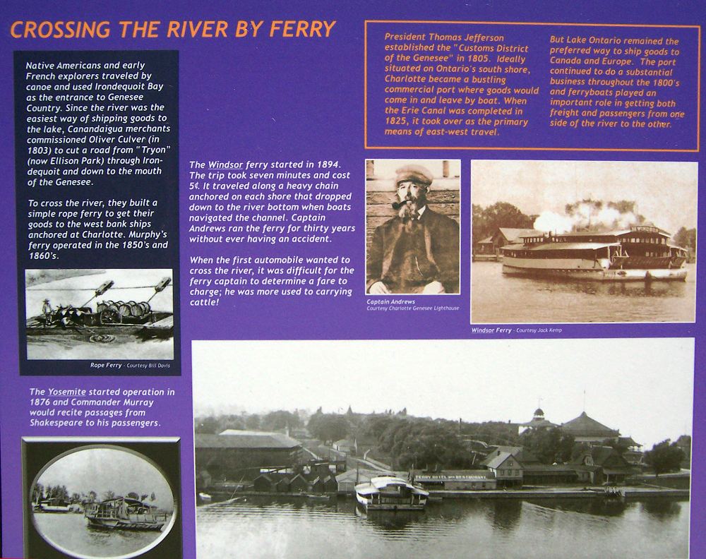
Looking to the south is the Patrick O'Rorke Memorial bridge. 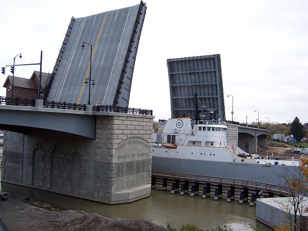 As early as the 1850's a bridge in this area was proposed but objections that a bridge would obstruct navigation to the upriver ports delayed construction until a lift bridge was opened in December, 1917. Prior to this the two shores were connected by a ferry. The original 28 foot clearance lift bridge was replaced with the current 45 foot clearance span in 2004.
At 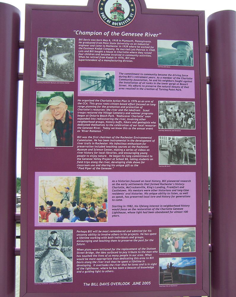 the NW corner of the bridge is the Bill Davis overlook. Bill and Lois Davis have been long time investigators and promoters of Charlotte and Genesee River history and were instrumental in reviving local interest in the Genesee River. This overlook gives a good view of the Port of Rochester and includes many signs displaying aspects of local history.
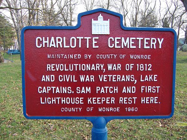
Continue under the bridge and walk south along River Street. Passing Petten Street, continue straight to the cemetery which is on your left.
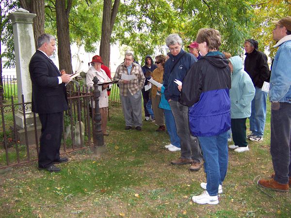
Charlotte Cemetery
 <
< 
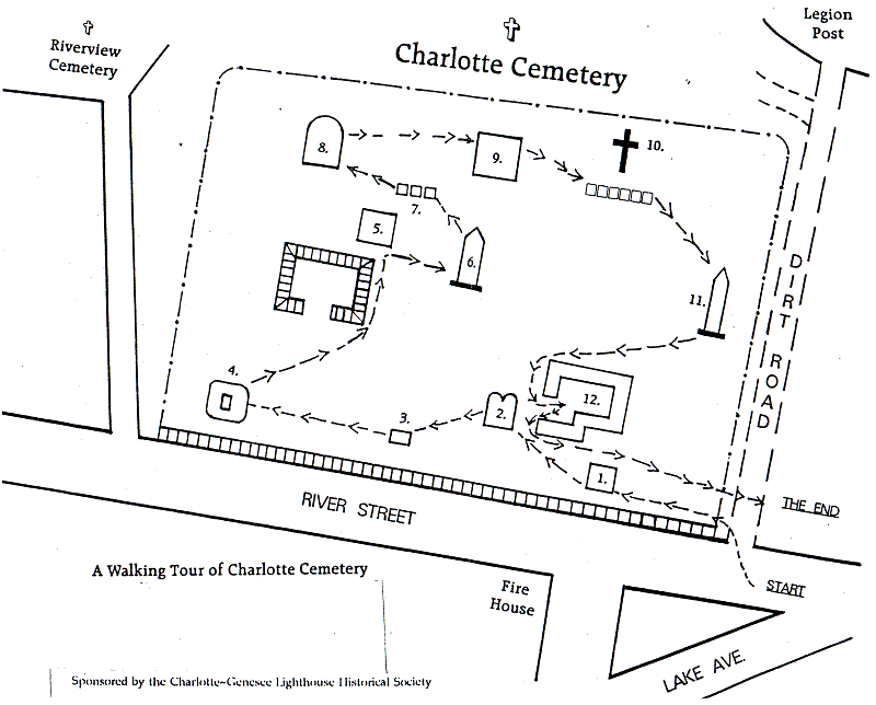
A Distinguished Dozen
1. Henry Newcomb 1803 - 1878
Philocha Newcomb 1810 - 1872
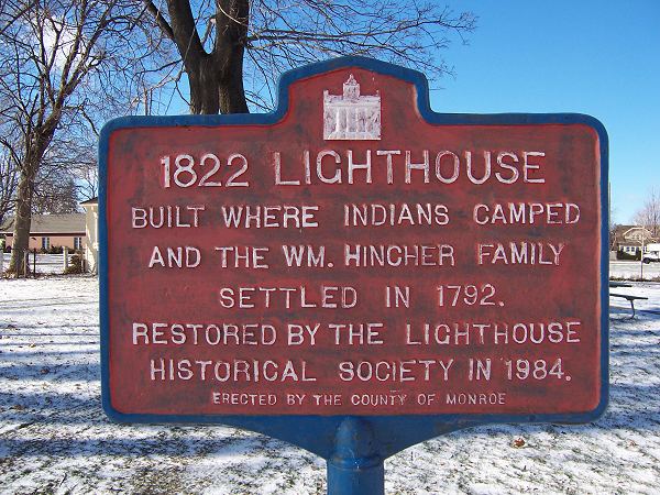
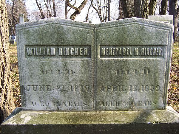
2. William and Mehitabel Hincher - In 1792, along with their eight children, became the first white settlers on Lake Ontario between the Genesee and Niagara Rivers. The Charlotte Genesee lighthouse stands on land once owned by the Hinchers.
3. The beloved Ross boy.
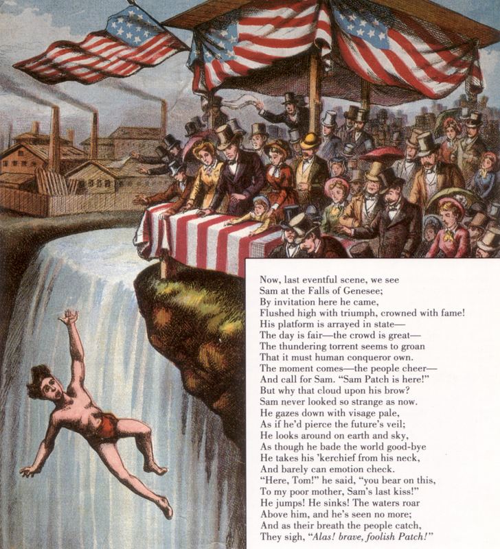
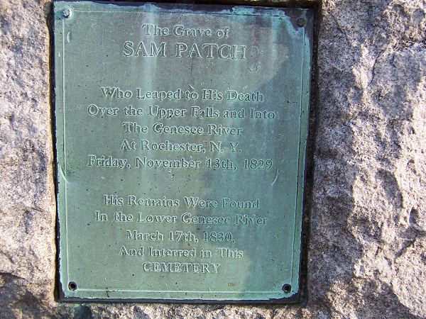
4. Sam Patch - The story of Sam Patch is well know. A good summary can be found at:
5. Michael Cook - A stone mason who moved his family here from the Hudson Valley so he could work on the stone lighthouse.
6. Sam Latta - Bought land bounded on the east by the Genesee River and on the north by Lake Ontario and settled there in 1806. He was the first Collector of the port of the Genesee and surveyed the present Latta Road from the Genesee river to the Parma town line.
7. Henry Pollard - He was the village blacksmith.
8. George Latta - Sam's younger brother was an entrepreneur and businessman.
9. Hiram Cook - 1842 -1918
10. Stones - there are many. Stoddard is one of the first children born in what is now Rochester.
11. Amos Emerson - Charlotte's first physician. In 1830 he bought an acre of land on the east side of Broadway (now Lake Avenue) and built his home and office there.
12. Giles Holden - From Middlebury, Vermont he settled here in 1817 having been appointed deputy collector and surveyor of the port. In 1819 with the intention of staying he purchased 100 acres of land. When the stone lighthouse was built in 1822 he was appointed its first keeper a position he held for 12 years.
Retrace your steps and turn right on Petten Street.
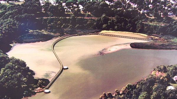
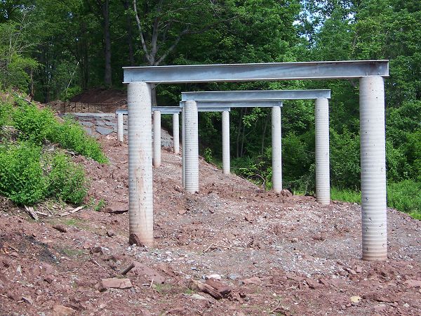
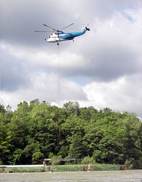
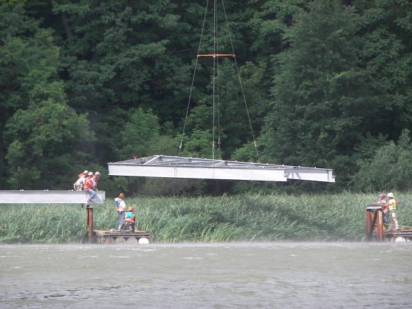
Turning Point North
On November 1, 2006 a new section of the Genesee Riverway Trail was opened. This section includes an elevated walkway over the turning basin at Turning Point Park. The following pictures show an artist's concept of the walkway proposal
and some of the early construction.
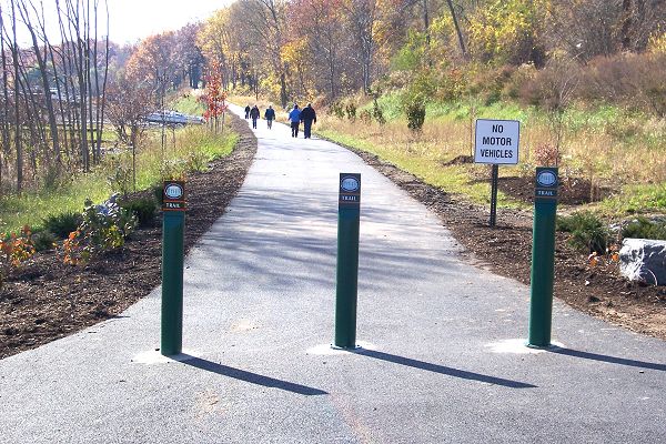 In a very short distance you will cross some railroad tracks. The new section of trail is on your right. The trail is paved and from here it is 0.6 miles to the beginning of the elevated walkway and 1.1 miles (straight line distance) to the end of the walkway at the south side of the turning basin.
 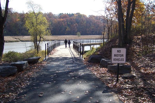 On your left are marinas and boat docks. The area after the docks is called Turning Point North. At the end of the elevated walkway is the area most people think of as Turning Point Park. Turning right up the hill will take you to the parking lot.
 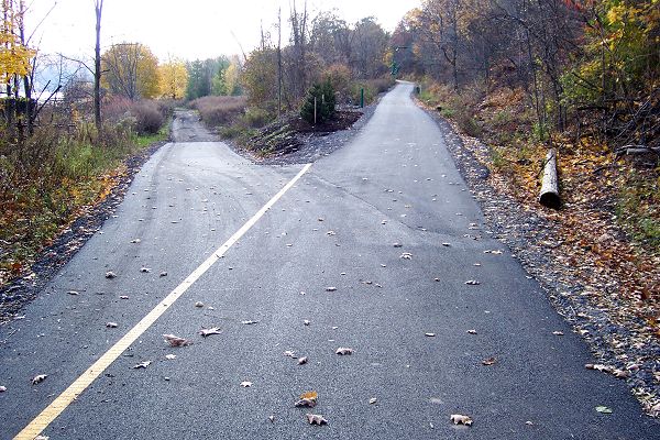 Many people make round trips between this lot and the one at Petten Street. Continuing straight (recommended) will take you to a fork. Take the trail on the right which ascends along the old railroad bed to the upper level. This was the route trains took coal cars down to the car ferry. Once at the upper level turning left will take you to Lake Avenue. Turning right will lake you to the Turning Point Park parking lot.
Turning Point Park
This land was purchased by the city in 1973 and opened as a park in May 1977. There are two turning basins on the lower Genesee, one at the Port of Rochester and the second here, at the area formerly known as Genesee Dock. The basin here served the Ontario Car Ferry and the cement terminal. It should be pointed out that the cars referred to were train cars.
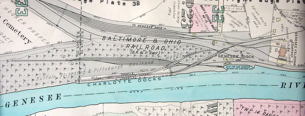
"The project that gave the greatest impetus to the port's development during the last half-century was the Ontario Car Ferry. Incorporated in Ottawa in 1905 and jointly backed by the Grand Trunk and the B. R. & P. railroads, this $500,000 enterprise launched its first ferry, the "Ontario I" in November 1907. A ferry slip was built near the coal trestle some two miles up the river where the B. R. & P. trains could bump their coal cars onto the "floating freight yard" as the Ontario I was described. A sister ship, the "Ontario II" was soon added, and the two ferries carried passengers and other cargo, too, back and forth between Rochester and Cobourg winter and summer for nearly fifty years. But their chief function in the early years was to deliver coal cars to the Grand Trunk- later the Canadian National Railroad - and to bring the empties back to Rochester." - Blake McKelvy, The Port of Rochester, Rochester History, XVI(4), October 1954


In Remembering the Ontario No. 1 and the Ontario No. 2, 43 Years of Sailing Lake Ontario in Calm, Gales and Ice, 1995, privately published, Lillian Roemer writes
"The Ontario No. 1 was a handsome vessel. She was always painted a spotless glowing white and her two raked stacks, set in tandem, were always buff with black tops.
On the main deck were four tracks with a capacity of 28 coal cars, each loaded car weighed 70 tons. An apron on the shore was raised or lowered to connect the rails on the boat with those on the shore. On this apron, at Charlotte, the four tracks formed an "X" to facilitate loading the cars on the outside tracks of the ferry. The apron and the stern of the ferry, when in proper position were securely clamped and the loading -- or taking off -- of the cars was done with ease.
The weight of the apron was equalized by means of a heavy sheet - metal bucket filled with scrap iron, mounted on a crane operated by hand power. This bucket weighed several tons and was raised to lower the apron
A yard engine pushing several flat cars [idlers] ahead of it to keep the weight of the engine off the apron, coupled the loaded cars to the flat cars and pushed the cars alternately on to the tracks on each side of the boat.
The Ontario No. 1 was licensed by the government to carry, 1000 passengers. The passenger deck had staterooms and cabins, dining salon and a large parlor, music room, as well as a ladies lounge and a rest room."
Later she says,
"In May 1916 with both boats on line the service became daily except Sunday from July to Labor Day, leaving Charlotte at 9:15 AM and starting back at 3:30 PM after a 75 minute layover at Cobourg. The schedule was cutback to 3 trips per week in June and September. There was no passenger service from October and May. In the 30's the company began the new service of carrying automobiles on flat cars, necessary because there was no highway access to Genesee Dock."
Ted Rafuse, Coal to Canada A History of the Ontario Car Ferry Company, Steampower Publishing, 2000, indicates the ferry carried passengers year round but from October to May the schedule was not regular and depended on the weather and coal car delivery needs. A passenger train from downtown Rochester to the Genesee Dock also ran only from June to September.
The Stephan B. Roman, a cement boat, still uses the docks here.
Follow the trailway south. It returns to Lake Avenue at the north side of Riverside Cemetery. This is about 0.5 miles south of Boxart Street. In 0.2 miles you will come to the entrance of Riverside Cemetery, one of Rochester's two public cemeteries, and about 0.25 miles further is the entrance to Holy Sepulchre Cemetery and the beginning of the section known as the Maplewood Trail.
Wildlife pictures taken from the Turning Point Walkway